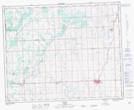
Maps showing Dawson's Hill, 9-33-1-W5, Alberta
Dawson's Hill is a Mountain located in 9-33-1-W5, Alberta.
- Latitude: 51° 48' 44'' North (decimal: 51.8122221)
- Longitude: 114° 5' 44'' West (decimal: -114.0955555)
- Topography Feature Category: Mountain
- Geographical Feature: Hill
- Canadian Province/Territory: Alberta
- Location: 9-33-1-W5
- Atlas of Canada Locator Map: Dawson's Hill
- GPS Coordinate Locator Map: Dawson's Hill Lat/Long