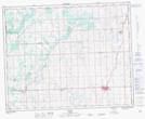
Maps showing Rice's Coulee, 31-32-2-W5, Alberta
Rice's Coulee is a Valley located in 31-32-2-W5, Alberta.
- Latitude: 51° 47' 31'' North (decimal: 51.7919444)
- Longitude: 114° 17' 00'' West (decimal: -114.2833333)
- Topography Feature Category: Valley
- Geographical Feature: Coulee
- Canadian Province/Territory: Alberta
- Location: 31-32-2-W5
- Atlas of Canada Locator Map: Rice's Coulee
- GPS Coordinate Locator Map: Rice's Coulee Lat/Long