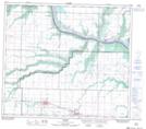
Maps showing Dunvegan Provincial Park, 80-4-W6, Alberta
Dunvegan Provincial Park is a Conservation area located in 80-4-W6, Alberta and has an elevation of 387 meters.
- Latitude: 55° 55' 25'' North (decimal: 55.9236000)
- Longitude: 118° 35' 40'' West (decimal: -118.5944000)
- Topography Feature Category: Conservation area
- Geographical Feature: Provincial Park
- Canadian Province/Territory: Alberta
- Elevation: 387 meters
- Location: 80-4-W6
- Atlas of Canada Locator Map: Dunvegan Provincial Park
- GPS Coordinate Locator Map: Dunvegan Provincial Park Lat/Long
Dunvegan Provincial Park NTS Map Sheets