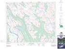
Maps showing North Molar Pass, Alberta
North Molar Pass is a Valley located in Alberta.
- Latitude: 51° 39' 23'' North (decimal: 51.6563888)
- Longitude: 116° 13' 30'' West (decimal: -116.2250000)
- Topography Feature Category: Valley
- Geographical Feature: Pass
- Canadian Province/Territory: Alberta
- Atlas of Canada Locator Map: North Molar Pass
- GPS Coordinate Locator Map: North Molar Pass Lat/Long