Maps showing Rocky Ridge, Alberta
Rocky Ridge is a Unincorporated area located in Alberta.
- Latitude: 51° 9' 50'' North (decimal: 51.1638888)
- Longitude: 114° 15' 40'' West (decimal: -114.2611111)
- Topography Feature Category: Unincorporated area
- Geographical Feature: Urban Community
- Canadian Province/Territory: Alberta
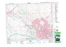
- Atlas of Canada Locator Map: Rocky Ridge
- GPS Coordinate Locator Map: Rocky Ridge Lat/Long