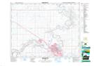
Maps showing South Ridge, Alberta
South Ridge is a Unincorporated area located in Alberta.
- Latitude: 50° 0' 20'' North (decimal: 50.0055555)
- Longitude: 110° 41' 10'' West (decimal: -110.6861110)
- Topography Feature Category: Unincorporated area
- Geographical Feature: Urban Community
- Canadian Province/Territory: Alberta
- Atlas of Canada Locator Map: South Ridge
- GPS Coordinate Locator Map: South Ridge Lat/Long
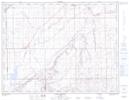
South Ridge NTS Map Sheets