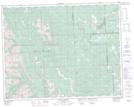
Maps showing Redwood Meadows, 28-23-4-W5, Alberta
Redwood Meadows is a Unincorporated area located in 28-23-4-W5, Alberta.
- Latitude: 50° 59' 7'' North (decimal: 50.9852778)
- Longitude: 114° 31' 00'' West (decimal: -114.5166666)
- Topography Feature Category: Unincorporated area
- Geographical Feature: Townsite
- Canadian Province/Territory: Alberta
- Location: 28-23-4-W5
- Atlas of Canada Locator Map: Redwood Meadows
- GPS Coordinate Locator Map: Redwood Meadows Lat/Long
Redwood Meadows NTS Map Sheets