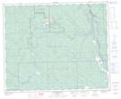
Maps showing Sunchild 202, 2-43-10-W5, Alberta
Sunchild 202 is a Indian Reserve located in 2-43-10-W5, Alberta.
- Latitude: 52° 40' 36'' North (decimal: 52.6767000)
- Longitude: 115° 20' 31'' West (decimal: -115.3418999)
- Topography Feature Category: Indian Reserve
- Geographical Feature: Indian Reserve - Réserve indienne
- Canadian Province/Territory: Alberta
- Location: 2-43-10-W5
- Atlas of Canada Locator Map: Sunchild 202
- GPS Coordinate Locator Map: Sunchild 202 Lat/Long
Sunchild 202 NTS Map Sheets