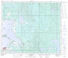
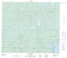
Maps showing Heart Lake 167, 69,70-10,11-W4, Alberta
Heart Lake 167 is a Indian Reserve located in 69,70-10,11-W4, Alberta.
- Latitude: 55° 00' North (decimal: 54.9999999)
- Longitude: 111° 30' West (decimal: -111.4999999)
- Topography Feature Category: Indian Reserve
- Geographical Feature: Indian Reserve - Réserve indienne
- Canadian Province/Territory: Alberta
- Location: 69,70-10,11-W4
- Atlas of Canada Locator Map: Heart Lake 167
- GPS Coordinate Locator Map: Heart Lake 167 Lat/Long
Heart Lake 167 NTS Map Sheets