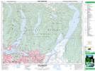
Maps showing Brentwood Park, New Westminster Land District, British Columbia
Brentwood Park is a Unincorporated area located in New Westminster Land District, British Columbia and has an elevation of 83 meters.
- Latitude: 49° 16' 30'' North (decimal: 49.2750000)
- Longitude: 122° 59' 30'' West (decimal: -122.9916999)
- Topography Feature Category: Unincorporated area
- Geographical Feature: Community
- Canadian Province/Territory: British Columbia
- Elevation: 83 meters
- Location: New Westminster Land District
- Atlas of Canada Locator Map: Brentwood Park
- GPS Coordinate Locator Map: Brentwood Park Lat/Long
Brentwood Park NTS Map Sheets