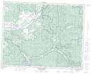
Maps showing Bolean Creek, British Columbia
Bolean Creek is a River located in British Columbia.
- Latitude: 50° 32' 20'' North (decimal: 50.5388999)
- Longitude: 119° 36' 0'' West (decimal: -119.6000000)
- Topography Feature Category: River
- Geographical Feature: Creek
- Canadian Province/Territory: British Columbia
- GPS Coordinate Locator Map: Bolean Creek Lat/Long