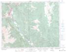
Maps showing Fountain Peak, Lillooet Land District, British Columbia
Fountain Peak is a Mountain located in Lillooet Land District, British Columbia and has an elevation of 1411 meters.
- Latitude: 50° 42' 57'' North (decimal: 50.7158333)
- Longitude: 121° 52' 23'' West (decimal: -121.873056)
- Topography Feature Category: Mountain
- Geographical Feature: Peak
- Canadian Province/Territory: British Columbia
- Elevation: 1411 meters
- Location: Lillooet Land District
- Atlas of Canada Locator Map: Fountain Peak
- GPS Coordinate Locator Map: Fountain Peak Lat/Long