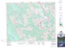
Maps showing The Marshall, Kootenay Land District, British Columbia
The Marshall is a Mountain located in Kootenay Land District, British Columbia and has an elevation of 2862 meters.
- Latitude: 50° 52' 46'' North (decimal: 50.8794444)
- Longitude: 115° 41' 37'' West (decimal: -115.6936111)
- Topography Feature Category: Mountain
- Geographical Feature: Mountain
- Canadian Province/Territory: British Columbia
- Elevation: 2862 meters
- Location: Kootenay Land District
- Atlas of Canada Locator Map: The Marshall
- GPS Coordinate Locator Map: The Marshall Lat/Long
The Marshall NTS Map Sheets