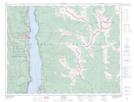
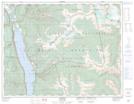
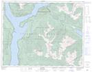
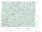
Maps showing Blue Ridge, Kootenay Land District, British Columbia
Blue Ridge is a Mountain located in Kootenay Land District, British Columbia and has an elevation of 1198 meters.
- Latitude: 50° 1' 4'' North (decimal: 50.0177779)
- Longitude: 116° 59' 00'' West (decimal: -116.9833330)
- Topography Feature Category: Mountain
- Geographical Feature: Ridge
- Canadian Province/Territory: British Columbia
- Elevation: 1198 meters
- Location: Kootenay Land District
- Atlas of Canada Locator Map: Blue Ridge
- GPS Coordinate Locator Map: Blue Ridge Lat/Long
Blue Ridge NTS Map Sheets