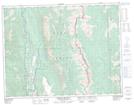
Maps showing Harmer Ridge, Kootenay Land District, British Columbia
Harmer Ridge is a Mountain located in Kootenay Land District, British Columbia.
- Latitude: 49° 47' 45'' North (decimal: 49.7958333)
- Longitude: 114° 49' 31'' West (decimal: -114.8252777)
- Topography Feature Category: Mountain
- Geographical Feature: Ridge
- Canadian Province/Territory: British Columbia
- Location: Kootenay Land District
- Atlas of Canada Locator Map: Harmer Ridge
- GPS Coordinate Locator Map: Harmer Ridge Lat/Long
Harmer Ridge NTS Map Sheets