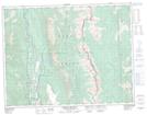
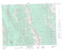
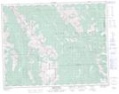
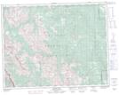
Maps showing Elk River, Kootenay Land District, British Columbia
Elk River is a River located in Kootenay Land District, British Columbia and has an elevation of 772 meters.
- Latitude: 49° 10' North (decimal: 49.1666999)
- Longitude: 115° 13' West (decimal: -115.2166999)
- Topography Feature Category: River
- Geographical Feature: River
- Canadian Province/Territory: British Columbia
- Elevation: 772 meters
- Location: Kootenay Land District
- Atlas of Canada Locator Map: Elk River
- GPS Coordinate Locator Map: Elk River Lat/Long
Elk River NTS Map Sheets
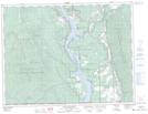
082G03 Lake Koocanusa Topographic Map at 1:50,000 scale
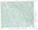
082G06 Elko Topographic Map at 1:50,000 scale
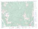
082G11 Fernie Topographic Map at 1:50,000 scale
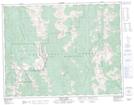
082G14 Queen Creek Topographic Map at 1:50,000 scale
082G15 Tornado Mountain Topographic Map at 1:50,000 scale
082J02 Fording River Topographic Map at 1:50,000 scale
082J07 Mount Head Topographic Map at 1:50,000 scale
082J10 Mount Rae Topographic Map at 1:50,000 scale
082J11 Kananaskis Lakes Topographic Map at 1:50,000 scale
082G Fernie Topographic Map at 1:250,000 scale
082J Kananaskis Lakes Topographic Map at 1:250,000 scale