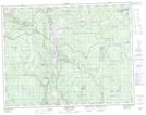
Maps showing Logan Lake, Kamloops Division Yale Land District, British Columbia
Logan Lake is a District municipality located in Kamloops Division Yale Land District, British Columbia and has an elevation of 1110 meters.
- Latitude: 50° 29' 40'' North (decimal: 50.4944444)
- Longitude: 120° 48' 52'' West (decimal: -120.814444)
- Topography Feature Category: District municipality
- Geographical Feature: District Municipality
- Canadian Province/Territory: British Columbia
- Elevation: 1110 meters
- Location: Kamloops Division Yale Land District
- Atlas of Canada Locator Map: Logan Lake
- GPS Coordinate Locator Map: Logan Lake Lat/Long
Logan Lake NTS Map Sheets