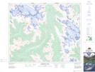
Maps showing Mount Poland, Kootenay Land District, British Columbia
Mount Poland is a Mountain located in Kootenay Land District, British Columbia and has an elevation of 2495 meters.
- Latitude: 51° 38' 28'' North (decimal: 51.6411111)
- Longitude: 116° 48' 17'' West (decimal: -116.8047222)
- Topography Feature Category: Mountain
- Geographical Feature: Mount
- Canadian Province/Territory: British Columbia
- Elevation: 2495 meters
- Location: Kootenay Land District
- Atlas of Canada Locator Map: Mount Poland
- GPS Coordinate Locator Map: Mount Poland Lat/Long
Mount Poland NTS Map Sheets