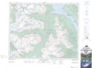
Maps showing The Horn, Kootenay Land District, British Columbia
The Horn is a Mountain located in Kootenay Land District, British Columbia and has an elevation of 2783 meters.
- Latitude: 51° 44' 29'' North (decimal: 51.7413888)
- Longitude: 117° 55' 12'' West (decimal: -117.9199999)
- Topography Feature Category: Mountain
- Geographical Feature: Peak
- Canadian Province/Territory: British Columbia
- Elevation: 2783 meters
- Location: Kootenay Land District
- Atlas of Canada Locator Map: The Horn
- GPS Coordinate Locator Map: The Horn Lat/Long
The Horn NTS Map Sheets