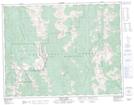
Maps showing Mount Washburn, Kootenay Land District, British Columbia
Mount Washburn is a Mountain located in Kootenay Land District, British Columbia and has an elevation of 2539 meters.
- Latitude: 49° 47' 38'' North (decimal: 49.7938888)
- Longitude: 115° 5' 24'' West (decimal: -115.0899999)
- Topography Feature Category: Mountain
- Geographical Feature: Mount
- Canadian Province/Territory: British Columbia
- Elevation: 2539 meters
- Location: Kootenay Land District
- Atlas of Canada Locator Map: Mount Washburn
- GPS Coordinate Locator Map: Mount Washburn Lat/Long