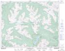
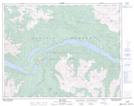
Maps showing Royal Peak, Lillooet Land District, British Columbia
Royal Peak is a Mountain located in Lillooet Land District, British Columbia and has an elevation of 2075 meters.
- Latitude: 50° 42' 49'' North (decimal: 50.7136111)
- Longitude: 122° 37' 32'' West (decimal: -122.6255555)
- Topography Feature Category: Mountain
- Geographical Feature: Peak
- Canadian Province/Territory: British Columbia
- Elevation: 2075 meters
- Location: Lillooet Land District
- Atlas of Canada Locator Map: Royal Peak
- GPS Coordinate Locator Map: Royal Peak Lat/Long
Royal Peak NTS Map Sheets