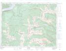
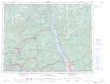
Maps showing Mount Mephistopheles, Kootenay Land District, British Columbia
Mount Mephistopheles is a Mountain located in Kootenay Land District, British Columbia and has an elevation of 2473 meters.
- Latitude: 49° 49' 52'' North (decimal: 49.8311111)
- Longitude: 117° 43' 14'' West (decimal: -117.7205555)
- Topography Feature Category: Mountain
- Geographical Feature: Mount
- Canadian Province/Territory: British Columbia
- Elevation: 2473 meters
- Location: Kootenay Land District
- Atlas of Canada Locator Map: Mount Mephistopheles
- GPS Coordinate Locator Map: Mount Mephistopheles Lat/Long