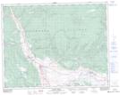
Maps showing Rattlesnake Hill, Kamloops Division Yale Land District, British Columbia
Rattlesnake Hill is a Mountain located in Kamloops Division Yale Land District, British Columbia and has an elevation of 604 meters.
- Latitude: 50° 45' 25'' North (decimal: 50.7569444)
- Longitude: 121° 12' 59'' West (decimal: -121.216389)
- Topography Feature Category: Mountain
- Geographical Feature: Hill
- Canadian Province/Territory: British Columbia
- Elevation: 604 meters
- Location: Kamloops Division Yale Land District
- Atlas of Canada Locator Map: Rattlesnake Hill
- GPS Coordinate Locator Map: Rattlesnake Hill Lat/Long
Rattlesnake Hill NTS Map Sheets