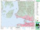
Maps showing Turpin Creek, New Westminster Land District, British Columbia
Turpin Creek is a River located in New Westminster Land District, British Columbia and has an elevation of 309 meters.
- Latitude: 49° 25' 28'' North (decimal: 49.4244444)
- Longitude: 123° 13' 59'' West (decimal: -123.2330555)
- Topography Feature Category: River
- Geographical Feature: Creek
- Canadian Province/Territory: British Columbia
- Elevation: 309 meters
- Location: New Westminster Land District
- Atlas of Canada Locator Map: Turpin Creek
- GPS Coordinate Locator Map: Turpin Creek Lat/Long
Turpin Creek NTS Map Sheets