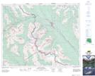
Maps showing Seven Veils Falls, Kootenay Land District, British Columbia
Seven Veils Falls is a Falls located in Kootenay Land District, British Columbia and has an elevation of 2205 meters.
- Latitude: 51° 21' 25'' North (decimal: 51.3568999)
- Longitude: 116° 19' 25'' West (decimal: -116.3235999)
- Topography Feature Category: Falls
- Geographical Feature: Falls
- Canadian Province/Territory: British Columbia
- Elevation: 2205 meters
- Location: Kootenay Land District
- Atlas of Canada Locator Map: Seven Veils Falls
- GPS Coordinate Locator Map: Seven Veils Falls Lat/Long