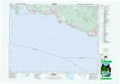
Maps showing Gower Point, New Westminster Land District, British Columbia
Gower Point is a Unincorporated area located in New Westminster Land District, British Columbia.
- Latitude: 49° 23' 20'' North (decimal: 49.3889000)
- Longitude: 123° 31' 30'' West (decimal: -123.5250000)
- Topography Feature Category: Unincorporated area
- Geographical Feature: Community
- Canadian Province/Territory: British Columbia
- Location: New Westminster Land District
- GPS Coordinate Locator Map: Gower Point Lat/Long