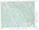
Maps showing HahaLake, Kootenay Land District, British Columbia
HahaLake is a Lake located in Kootenay Land District, British Columbia and has an elevation of 852 meters.
- Latitude: 49° 25' 44'' North (decimal: 49.4288889)
- Longitude: 115° 29' 25'' West (decimal: -115.490278)
- Topography Feature Category: Lake
- Geographical Feature: Lake
- Canadian Province/Territory: British Columbia
- Elevation: 852 meters
- Location: Kootenay Land District
- Atlas of Canada Locator Map: HahaLake
- GPS Coordinate Locator Map: HahaLake Lat/Long