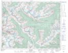
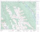
Maps showing Mount Macdonald Tunnel, Kootenay Land District, British Columbia
Mount Macdonald Tunnel is a Road feature located in Kootenay Land District, British Columbia.
- Latitude: 51° 17' 35'' North (decimal: 51.2930999)
- Longitude: 117° 29' 50'' West (decimal: -117.4972000)
- Topography Feature Category: Road feature
- Geographical Feature: Tunnel
- Canadian Province/Territory: British Columbia
- Location: Kootenay Land District
- Atlas of Canada Locator Map: Mount Macdonald Tunnel
- GPS Coordinate Locator Map: Mount Macdonald Tunnel Lat/Long
Mount Macdonald Tunnel NTS Map Sheets