Maps showing New Westminster Land District, British Columbia
New Westminster Land District is a Geographical area located in British Columbia.
- Latitude: 49° 44' North (decimal: 49.7333330)
- Longitude: 123° 5' West (decimal: -123.0833300)
- Topography Feature Category: Geographical area
- Geographical Feature: Land District
- Canadian Province/Territory: British Columbia
- Atlas of Canada Locator Map: New Westminster Land District
- GPS Coordinate Locator Map: New Westminster Land District Lat/Long
New Westminster Land District NTS Map Sheets
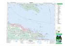
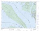
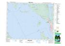
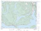
092F08 Parksville Topographic Map at 1:50,000 scale
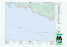
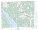
092F09 Texada Island Topographic Map at 1:50,000 scale
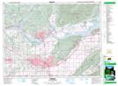
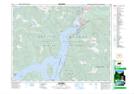
092F15 Powell River Topographic Map at 1:50,000 scale
092F16 Haslam Lake Topographic Map at 1:50,000 scale
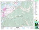
092G01 Mission Topographic Map at 1:50,000 scale
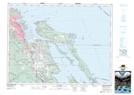
092G02 New Westminster Topographic Map at 1:50,000 scale
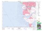
092G03 Lulu Island Topographic Map at 1:50,000 scale
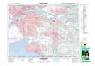
092G04 Nanaimo Topographic Map at 1:50,000 scale
092G05 Sechelt Topographic Map at 1:50,000 scale
092G11 Squamish Topographic Map at 1:50,000 scale
092H04 Chilliwack Topographic Map at 1:50,000 scale
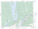
092H05 Harrison Lake Topographic Map at 1:50,000 scale
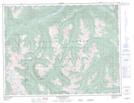
092H12 Mount Urquhart Topographic Map at 1:50,000 scale
092H13 Scuzzy Mountain Topographic Map at 1:50,000 scale
092F Port Alberni Topographic Map at 1:250,000 scale
092G Vancouver Topographic Map at 1:250,000 scale
092H Hope Topographic Map at 1:250,000 scale