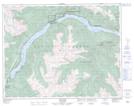
Maps showing Seton Lake 7, Lillooet Land District, British Columbia
Seton Lake 7 is a Indian Reserve located in Lillooet Land District, British Columbia.
- Latitude: 50° 42' 39'' North (decimal: 50.7108333)
- Longitude: 122° 16' 46'' West (decimal: -122.2794443)
- Topography Feature Category: Indian Reserve
- Geographical Feature: Indian Reserve - Réserve indienne
- Canadian Province/Territory: British Columbia
- Location: Lillooet Land District
- Atlas of Canada Locator Map: Seton Lake 7
- GPS Coordinate Locator Map: Seton Lake 7 Lat/Long