Canada Topographic Maps

Norway Bay Topo Maps

Topography maps and Latitude/Longitude Location

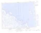
Maps showing Norway Bay, Nunavut

Norway Bay is a Bay located in Nunavut.

  • Latitude: 71° 6' North   (decimal: 71.1000000)
  • Longitude: 104° 28' West   (decimal: -104.4667000)
  • Topography Feature Category: Bay
  • Geographical Feature: Bay
  • Canadian Province/Territory: Nunavut
  • Atlas of Canada Locator Map: Norway Bay
  • GPS Coordinate Locator Map: Norway Bay Lat/Long

Norway Bay NTS Map Sheets

067F13 Cape Anker Topographic Map at 1:50,000 scale

077E16 Cape Sverdrup Topographic Map at 1:50,000 scale

077H01 Norway Bay Topographic Map at 1:50,000 scale

067F Denmark Bay Topographic Map at 1:250,000 scale

077E Washburn Lake Topographic Map at 1:250,000 scale

077H Cape Stang Topographic Map at 1:250,000 scale

 
Buy Topographic Maps DVD
Newsletter Sign-up

Yes, I want to receive map store discounts.


Bookmark and Share