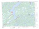
Maps showing All in the Way Island, Newfoundland and Labrador
All in the Way Island is a Island located in Newfoundland and Labrador and has an elevation of 0 meters.
- Latitude: 49° 8' 53'' North (decimal: 49.1480555)
- Longitude: 55° 18' 47'' West (decimal: -55.3130555)
- Topography Feature Category: Island
- Geographical Feature: Island
- Canadian Province/Territory: Newfoundland and Labrador
- Elevation: 0 meters
- Atlas of Canada Locator Map: All in the Way Island
- GPS Coordinate Locator Map: All in the Way Island Lat/Long