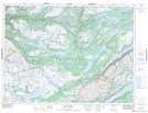
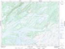
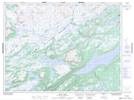
Maps showing Annieopsquotch Mountains, Newfoundland and Labrador
Annieopsquotch Mountains is a Mountain located in Newfoundland and Labrador and has an elevation of 397 meters.
- Latitude: 48° 20' 00'' North (decimal: 48.3333333)
- Longitude: 57° 29' 58'' West (decimal: -57.4994444)
- Topography Feature Category: Mountain
- Geographical Feature: Mountains
- Canadian Province/Territory: Newfoundland and Labrador
- Elevation: 397 meters
- Atlas of Canada Locator Map: Annieopsquotch Mountains
- GPS Coordinate Locator Map: Annieopsquotch Mountains Lat/Long
Annieopsquotch Mountains NTS Map Sheets