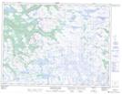
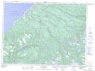
Maps showing Barachois Brook, Newfoundland and Labrador
Barachois Brook is a River located in Newfoundland and Labrador.
- Latitude: 48° 14' 40'' North (decimal: 48.2444444)
- Longitude: 58° 49' 37'' West (decimal: -58.8269444)
- Topography Feature Category: River
- Geographical Feature: Brook
- Canadian Province/Territory: Newfoundland and Labrador
- GPS Coordinate Locator Map: Barachois Brook Lat/Long
Barachois Brook NTS Map Sheets