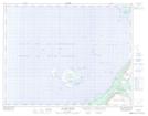
Maps showing Barr'd Harbour, Newfoundland and Labrador
Barr'd Harbour is a Unincorporated area located in Newfoundland and Labrador and has an elevation of 7 meters.
- Latitude: 50° 48' 44'' North (decimal: 50.8122222)
- Longitude: 57° 3' 18'' West (decimal: -57.0550000)
- Topography Feature Category: Unincorporated area
- Geographical Feature: Settlement
- Canadian Province/Territory: Newfoundland and Labrador
- Elevation: 7 meters
- Atlas of Canada Locator Map: Barr'd Harbour
- GPS Coordinate Locator Map: Barr'd Harbour Lat/Long
Barr'd Harbour NTS Map Sheets