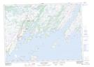
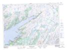
Maps showing Bay de l'Eau River, Newfoundland and Labrador
Bay de l'Eau River is a River located in Newfoundland and Labrador and has an elevation of 74 meters.
- Latitude: 47° 26' 16'' North (decimal: 47.4377777)
- Longitude: 54° 46' 57'' West (decimal: -54.7824999)
- Topography Feature Category: River
- Geographical Feature: River
- Canadian Province/Territory: Newfoundland and Labrador
- Elevation: 74 meters
- Atlas of Canada Locator Map: Bay de l'Eau River
- GPS Coordinate Locator Map: Bay de l'Eau River Lat/Long
Bay de l'Eau River NTS Map Sheets