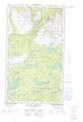
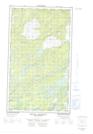
Maps showing Mount Benedict, Newfoundland and Labrador
Mount Benedict is a Mountain located in Newfoundland and Labrador and has an elevation of 566 meters.
- Latitude: 54° 44' 5'' North (decimal: 54.7347222)
- Longitude: 58° 30' 55'' West (decimal: -58.5152777)
- Topography Feature Category: Mountain
- Geographical Feature: Mount
- Canadian Province/Territory: Newfoundland and Labrador
- Elevation: 566 meters
- Atlas of Canada Locator Map: Mount Benedict
- GPS Coordinate Locator Map: Mount Benedict Lat/Long
Mount Benedict NTS Map Sheets