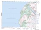
Maps showing Beverley Head, Bay of Islands, Newfoundland and Labrador
Beverley Head is a Cape located in Bay of Islands, Newfoundland and Labrador and has an elevation of 32 meters.
- Latitude: 49° 17' 19'' North (decimal: 49.2886111)
- Longitude: 58° 15' 15'' West (decimal: -58.2541666)
- Topography Feature Category: Cape
- Geographical Feature: Head
- Canadian Province/Territory: Newfoundland and Labrador
- Elevation: 32 meters
- Location: Bay of Islands
- Atlas of Canada Locator Map: Beverley Head
- GPS Coordinate Locator Map: Beverley Head Lat/Long
Beverley Head NTS Map Sheets