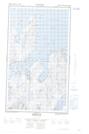
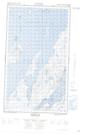
Maps showing Big Duck Island, Newfoundland and Labrador
Big Duck Island is a Island located in Newfoundland and Labrador.
- Latitude: 55° 4' 18'' North (decimal: 55.0717758)
- Longitude: 59° 23' 46'' West (decimal: -59.3961295)
- Topography Feature Category: Island
- Geographical Feature: Island
- Canadian Province/Territory: Newfoundland and Labrador
- Atlas of Canada Locator Map: Big Duck Island
- GPS Coordinate Locator Map: Big Duck Island Lat/Long
Big Duck Island NTS Map Sheets