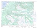
Maps showing Birchy Brook, Newfoundland and Labrador
Birchy Brook is a River located in Newfoundland and Labrador and has an elevation of 72 meters.
- Latitude: 48° 27' 46'' North (decimal: 48.4627777)
- Longitude: 58° 18' 12'' West (decimal: -58.3033333)
- Topography Feature Category: River
- Geographical Feature: Brook
- Canadian Province/Territory: Newfoundland and Labrador
- Elevation: 72 meters
- Atlas of Canada Locator Map: Birchy Brook
- GPS Coordinate Locator Map: Birchy Brook Lat/Long
Birchy Brook NTS Map Sheets