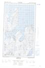
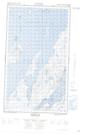
Maps showing The Black Family, Newfoundland and Labrador
The Black Family is a Shoal located in Newfoundland and Labrador and has an elevation of 0 meters.
- Latitude: 55° 9' 43'' North (decimal: 55.1618080)
- Longitude: 59° 3' 56'' West (decimal: -59.0655272)
- Topography Feature Category: Shoal
- Geographical Feature: Rocks
- Canadian Province/Territory: Newfoundland and Labrador
- Elevation: 0 meters
- Atlas of Canada Locator Map: The Black Family
- GPS Coordinate Locator Map: The Black Family Lat/Long
The Black Family NTS Map Sheets