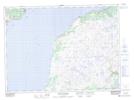
Maps showing Black River, Newfoundland and Labrador
Black River is a River located in Newfoundland and Labrador and has an elevation of 241 meters.
- Latitude: 47° 14' 00'' North (decimal: 47.2333333)
- Longitude: 55° 12' 17'' West (decimal: -55.2047222)
- Topography Feature Category: River
- Geographical Feature: River
- Canadian Province/Territory: Newfoundland and Labrador
- Elevation: 241 meters
- Atlas of Canada Locator Map: Black River
- GPS Coordinate Locator Map: Black River Lat/Long
Black River NTS Map Sheets