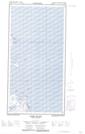
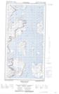
Maps showing Black Rock Point, Newfoundland and Labrador
Black Rock Point is a Cape located in Newfoundland and Labrador and has an elevation of 5 meters.
- Latitude: 60° 2' 3'' North (decimal: 60.0341282)
- Longitude: 64° 10' 16'' West (decimal: -64.1710998)
- Topography Feature Category: Cape
- Geographical Feature: Point
- Canadian Province/Territory: Newfoundland and Labrador
- Elevation: 5 meters
- Atlas of Canada Locator Map: Black Rock Point
- GPS Coordinate Locator Map: Black Rock Point Lat/Long
Black Rock Point NTS Map Sheets