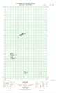
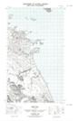
Maps showing Black Rocks, Newfoundland and Labrador
Black Rocks is a Shoal located in Newfoundland and Labrador.
- Latitude: 54° 14' 25'' North (decimal: 54.2403315)
- Longitude: 57° 22' 34'' West (decimal: -57.3761575)
- Topography Feature Category: Shoal
- Geographical Feature: Rocks
- Canadian Province/Territory: Newfoundland and Labrador
- Atlas of Canada Locator Map: Black Rocks
- GPS Coordinate Locator Map: Black Rocks Lat/Long
Black Rocks NTS Map Sheets