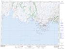
Maps showing Blow Me Down, Newfoundland and Labrador
Blow Me Down is a Cliff located in Newfoundland and Labrador and has an elevation of 73 meters.
- Latitude: 47° 39' 11'' North (decimal: 47.6530555)
- Longitude: 57° 32' 37'' West (decimal: -57.5436111)
- Topography Feature Category: Cliff
- Geographical Feature: Blow-Me-Down / Blow Me Down
- Canadian Province/Territory: Newfoundland and Labrador
- Elevation: 73 meters
- Atlas of Canada Locator Map: Blow Me Down
- GPS Coordinate Locator Map: Blow Me Down Lat/Long