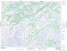
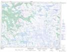
Maps showing Blue Hill, Newfoundland and Labrador
Blue Hill is a Mountain located in Newfoundland and Labrador and has an elevation of 427 meters.
- Latitude: 48° 12' 3'' North (decimal: 48.2007901)
- Longitude: 58° 0' 4'' West (decimal: -58.0011710)
- Topography Feature Category: Mountain
- Geographical Feature: Hill
- Canadian Province/Territory: Newfoundland and Labrador
- Elevation: 427 meters
- Atlas of Canada Locator Map: Blue Hill
- GPS Coordinate Locator Map: Blue Hill Lat/Long
Blue Hill NTS Map Sheets