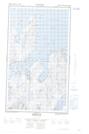
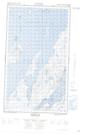
Maps showing The Bluff, Newfoundland and Labrador
The Bluff is a Cliff located in Newfoundland and Labrador and has an elevation of 10 meters.
- Latitude: 55° 10' 50'' North (decimal: 55.1806681)
- Longitude: 59° 7' 59'' West (decimal: -59.1329823)
- Topography Feature Category: Cliff
- Geographical Feature: Bluff
- Canadian Province/Territory: Newfoundland and Labrador
- Elevation: 10 meters
- Atlas of Canada Locator Map: The Bluff
- GPS Coordinate Locator Map: The Bluff Lat/Long
The Bluff NTS Map Sheets