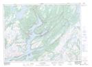
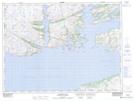
Maps showing Bois Island, Newfoundland and Labrador
Bois Island is a Island located in Newfoundland and Labrador and has an elevation of 45 meters.
- Latitude: 47° 43' 58'' North (decimal: 47.7327139)
- Longitude: 55° 59' 57'' West (decimal: -55.9991676)
- Topography Feature Category: Island
- Geographical Feature: Island
- Canadian Province/Territory: Newfoundland and Labrador
- Elevation: 45 meters
- Atlas of Canada Locator Map: Bois Island
- GPS Coordinate Locator Map: Bois Island Lat/Long
Bois Island NTS Map Sheets