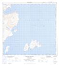
Maps showing Bradford Island, Newfoundland and Labrador
Bradford Island is a Island located in Newfoundland and Labrador.
- Latitude: 58° 45' 1'' North (decimal: 58.7501413)
- Longitude: 62° 52' 57'' West (decimal: -62.8823836)
- Topography Feature Category: Island
- Geographical Feature: Island
- Canadian Province/Territory: Newfoundland and Labrador
- Atlas of Canada Locator Map: Bradford Island
- GPS Coordinate Locator Map: Bradford Island Lat/Long
Bradford Island NTS Map Sheets