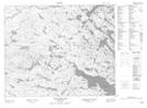
Maps showing Brazells Pond, Newfoundland and Labrador
Brazells Pond is a Lake located in Newfoundland and Labrador.
- Latitude: 52° 49' 32'' North (decimal: 52.8255922)
- Longitude: 56° 1' 49'' West (decimal: -56.0303815)
- Topography Feature Category: Lake
- Geographical Feature: Pond
- Canadian Province/Territory: Newfoundland and Labrador
- Atlas of Canada Locator Map: Brazells Pond
- GPS Coordinate Locator Map: Brazells Pond Lat/Long
Brazells Pond NTS Map Sheets